
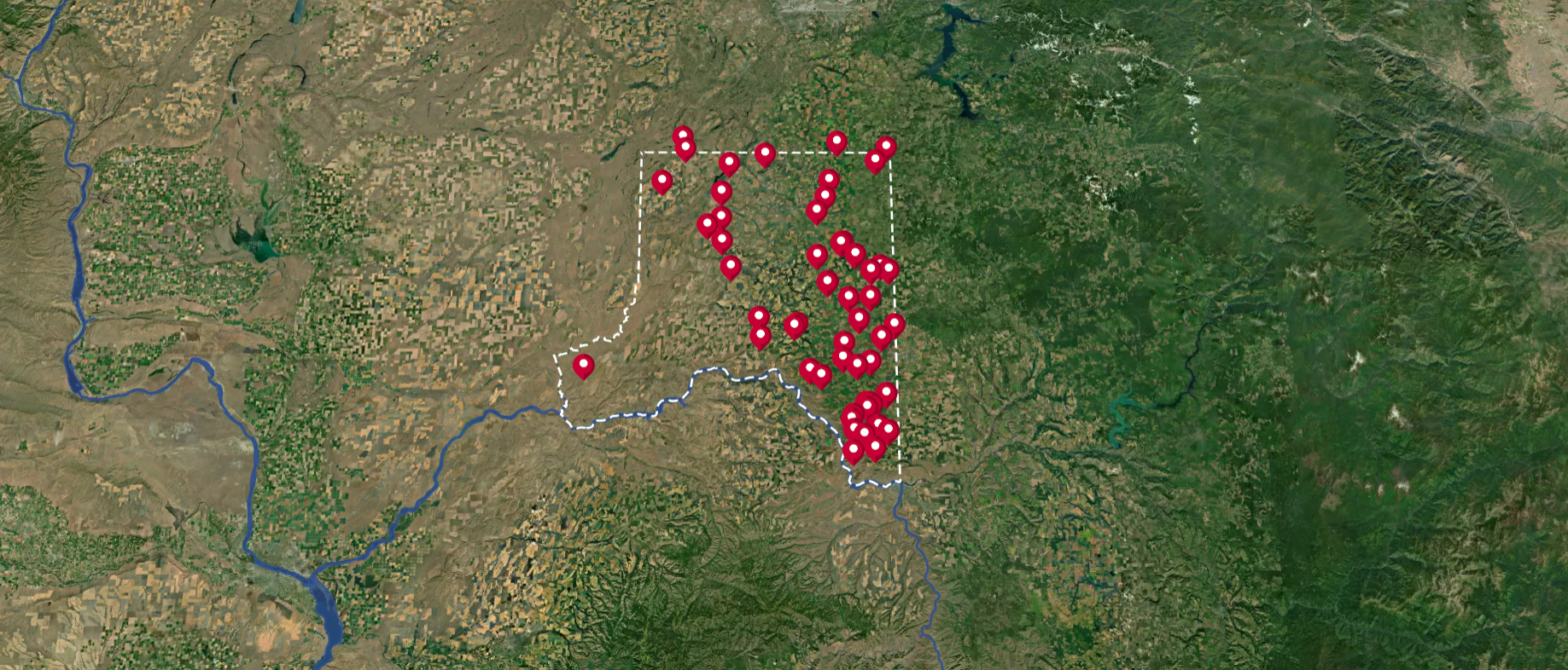
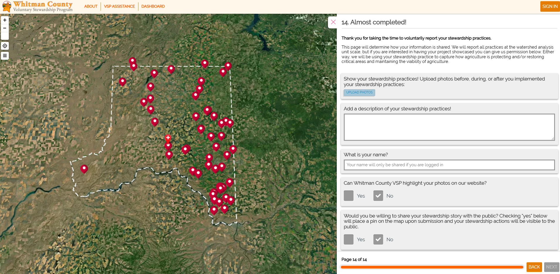
Farmers, ranchers, and landowners in Whitman County can tell their stewardship stories by completing the Action Map.
Each pin on the map represents a farm or ranch where stewardship practices are being implemented.
Whitman County has a successful stewardship story that will only get deeper with more information.
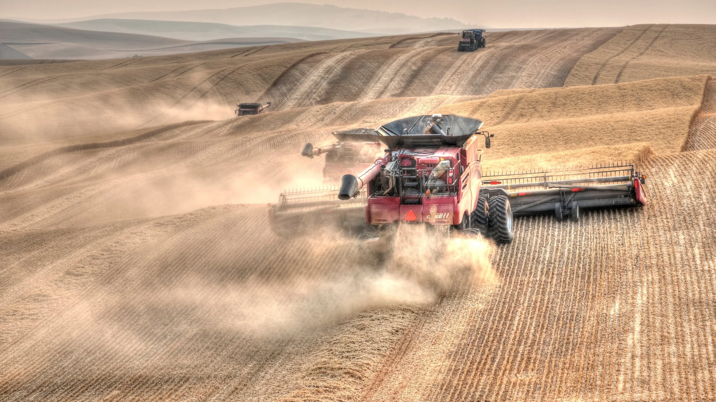
Whitman County farmers are doing some incredible conservation work, and the Action Map proves it.
The Voluntary Stewardship Program encourages farmers, ranchers, and landowners to share their stewardship stories as well as provides valuable information to policymakers in Olympia.
In Defense of Farmers, Ranchers and Landowners
The Whitman County Action Map is an online tool to collect stewardship data that can be presented to legislators at the state level. This data serves as a means to show that those who manage the land in Whitman County are already doing a lot of good.
Rather than requiring mandatory reporting through the Growth Management Act (GMA), Whitman County has opted to show protection of critical areas through voluntary data reporting on the Action Map.
How do I tell my story?
Step One:
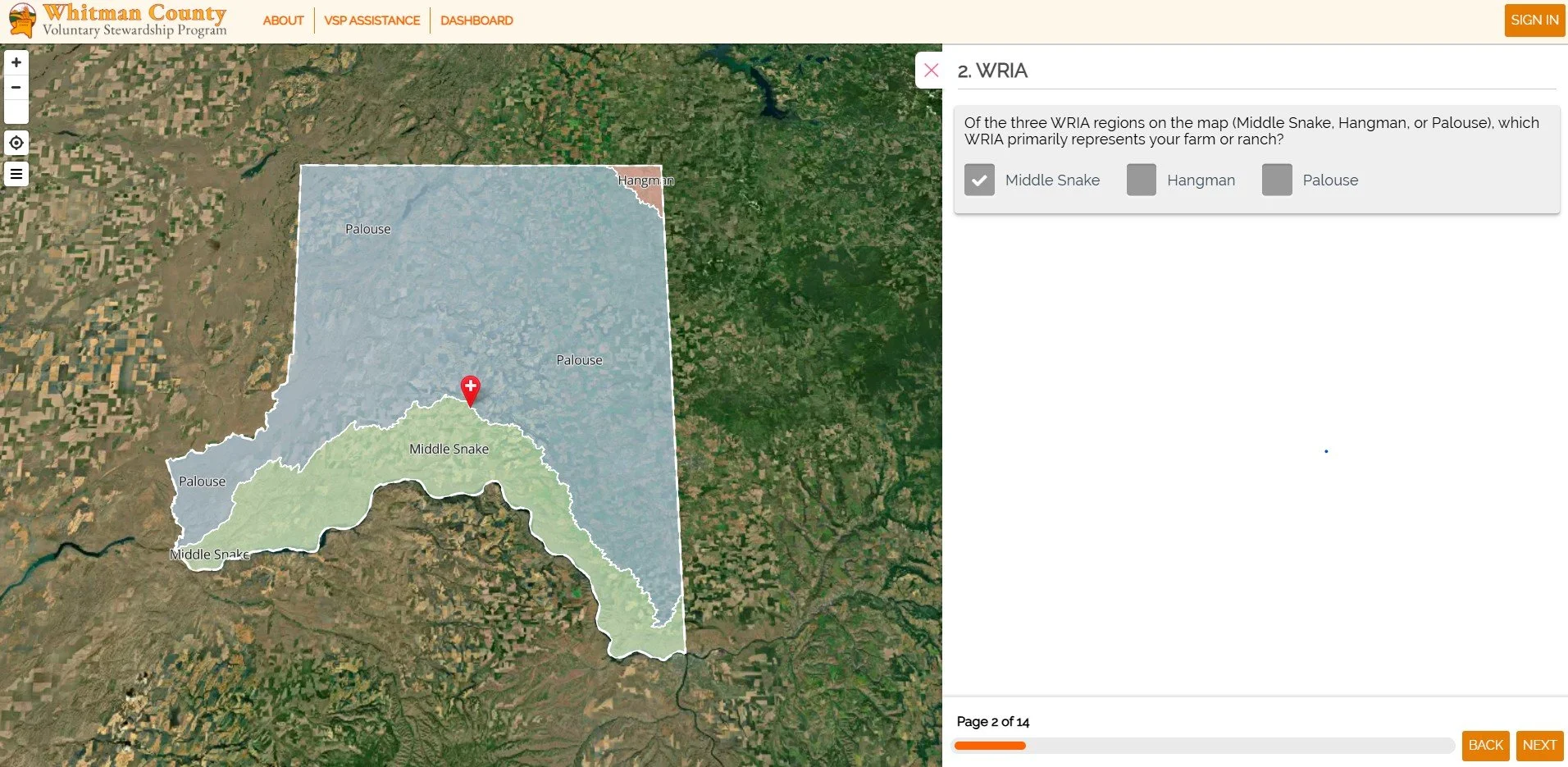
First, you will identify the field you would like to report, finding it on the Action Map.
Step Two:
Then, you will answer a series of questions about the land regarding which Water Resource Inventory Area (WRIA) it falls into, if there are any wetlands, frequently flooded areas, or severe geologic hazard areas, aquifers, or fish and wildlife conservation areas nearby.
Step Three:
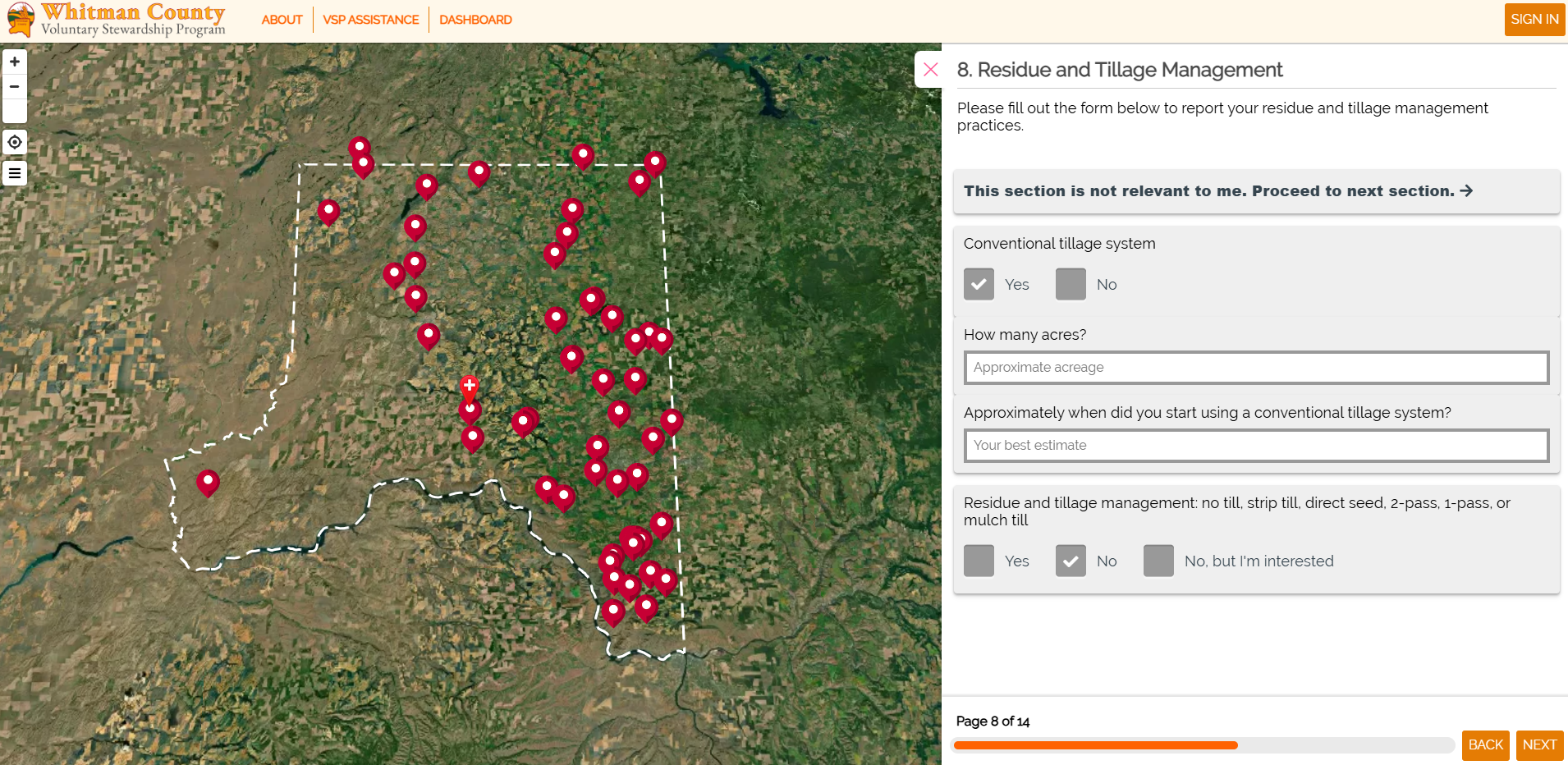
Next, you will identify conservation practices that you use and how many acres they are used on. These practices can fall under the following:
Residue and Tillage Management
Pest Management
Nutrient Management
Range Management
Soil and Erosion Management
Fish and Wildlife Management
Your information is protected. All data is reported at the county level. Producers can choose to keep their data private. Your field doesn't have to be pinned on the Action Map for your data to make a difference.
What will happen to my information?
Can I get help completing the Action Map?
Yes! You can reach out to your local Conservation District, and someone will walk you through the questionnaire.